 X
X
 facebook
 WhatsApp
 Email
Email
Introduction
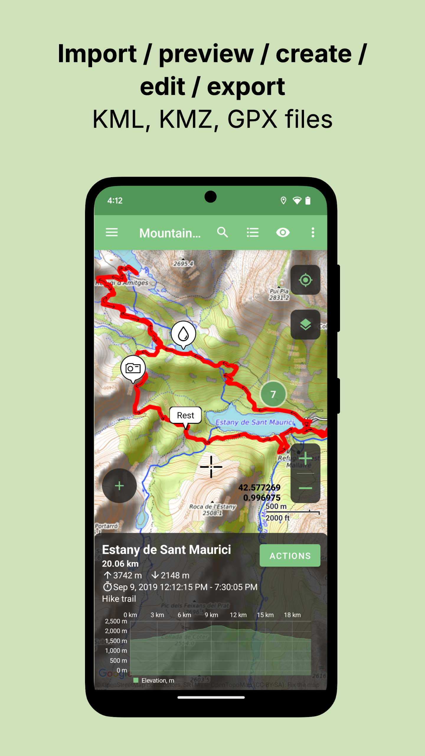
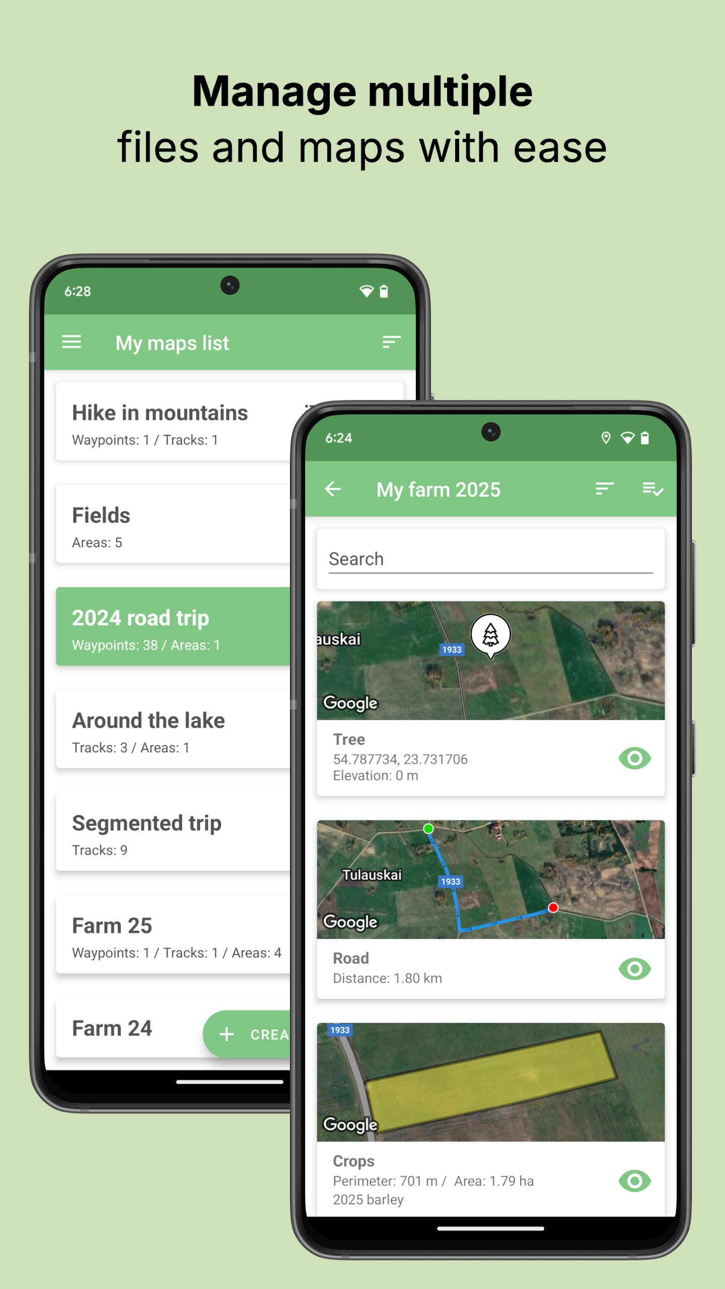
Tracklia is the ultimate app for adventurers who work with GPX, KML, or KMZ files. This allinone navigator allows you to import, record, edit, merge, split, annotate, and share your GPS tracks and waypoints effortlessly, without the need for a bulky desktop computer. With features like realtime GPS tracking, offline map support, and the ability to add geotagged photos to your waypoints, Tracklia is the perfect companion for planning and reliving your outdoor expeditions. Whether you're a hiker, biker, or explorer, Tracklia has everything you need to make the most out of your adventures.
Features of Tracklia:
Comprehensive File Support: Easily open and work with GPX, KML, and KMZ files without any hassle.
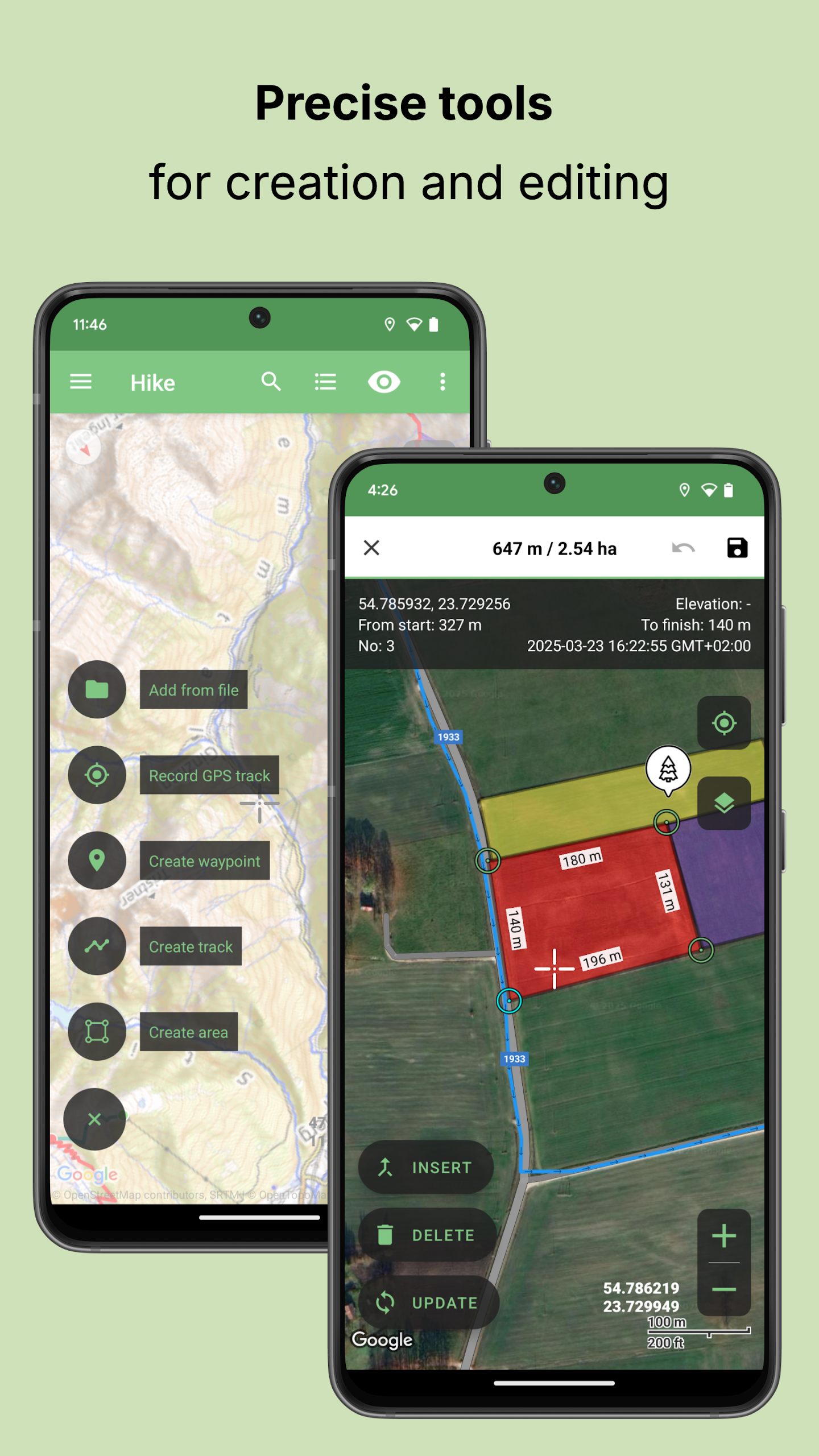
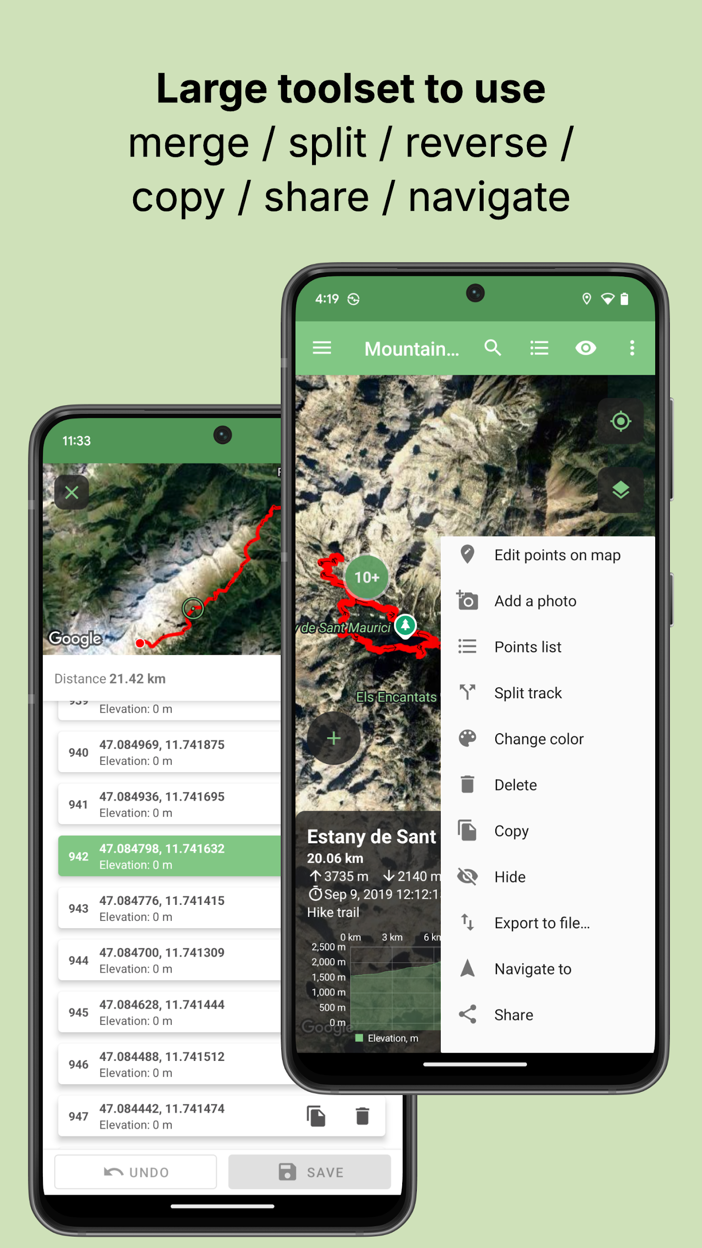
Editing Toolkit: Edit, merge, split, annotate, and customize your tracks, areas, and waypoints with ease using a variety of tools.
Creation & Export Options: Draw new tracks, drop waypoints, and export data to various file formats for seamless sharing and collaboration.
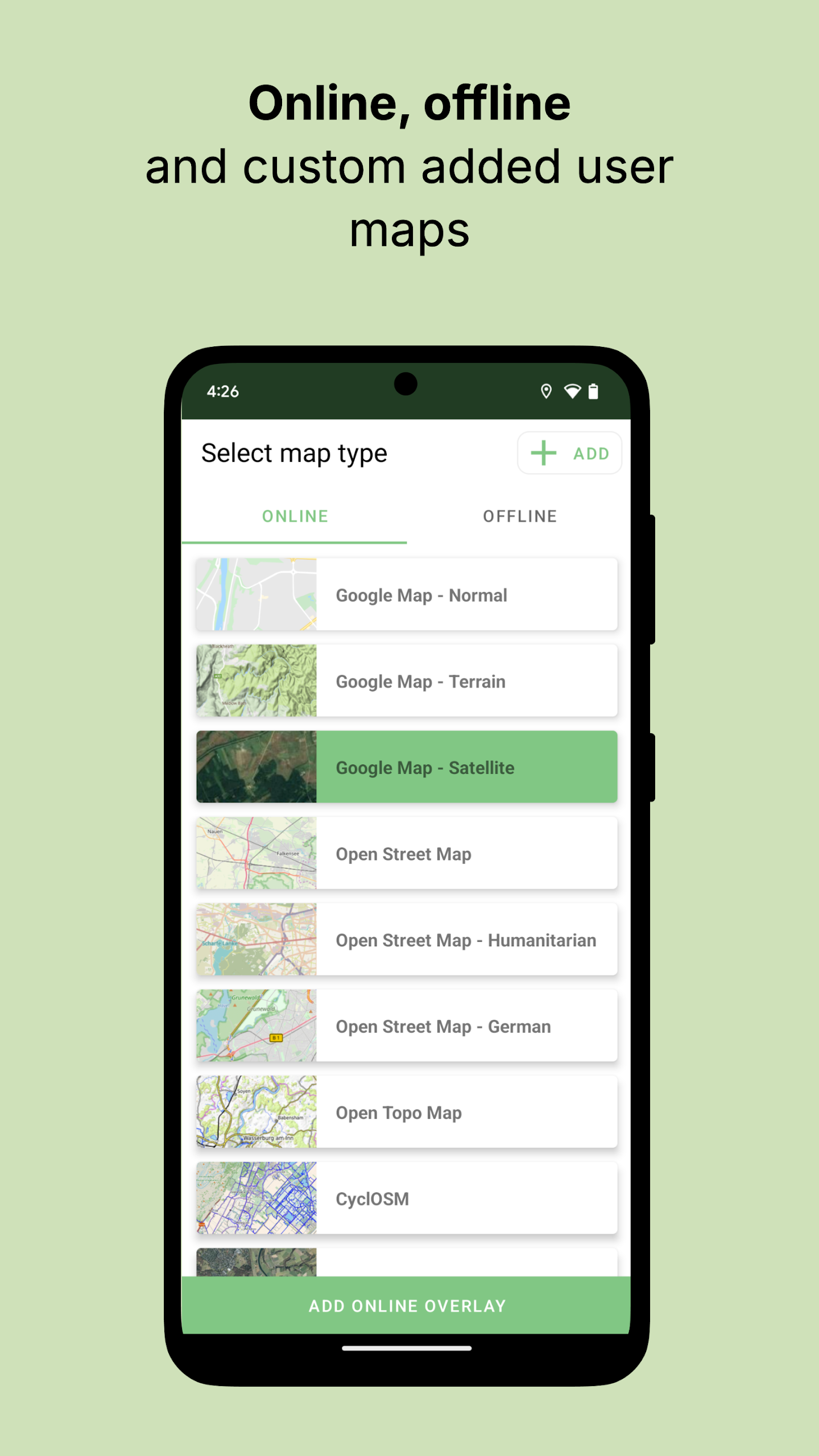
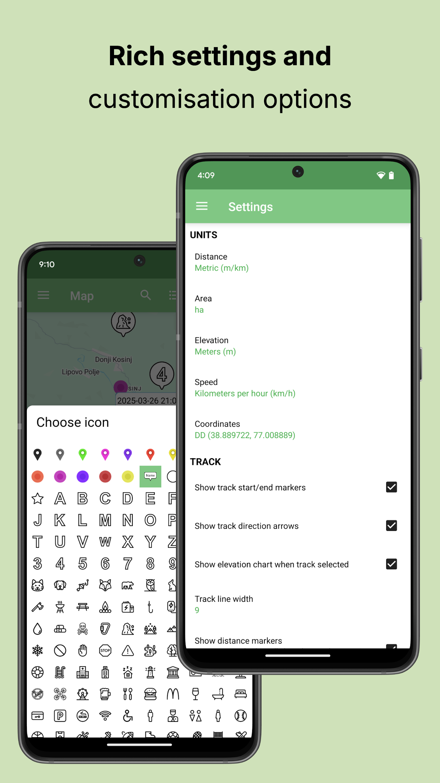
Map Choices: Access a range of map options including offline OpenStreetMap tiles and online Google Maps for a personalized navigation experience.
FAQs of Tracklia:
Can I import my existing GPS data into the app?
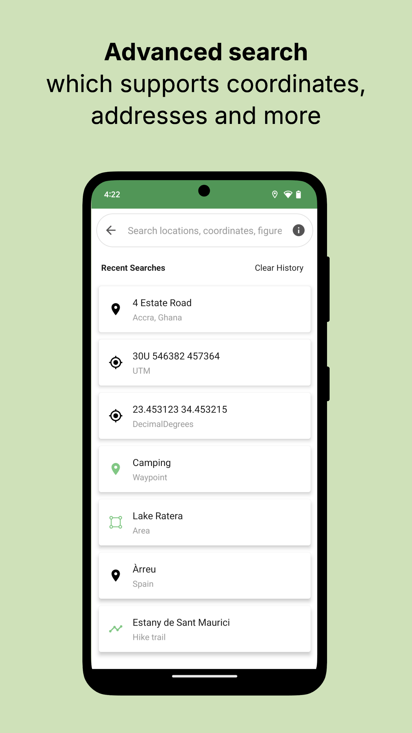
Yes, simply tap “Import” and select your GPX/KML/KMZ file from your preferred source to get started.
How can I record a new track while using the app?
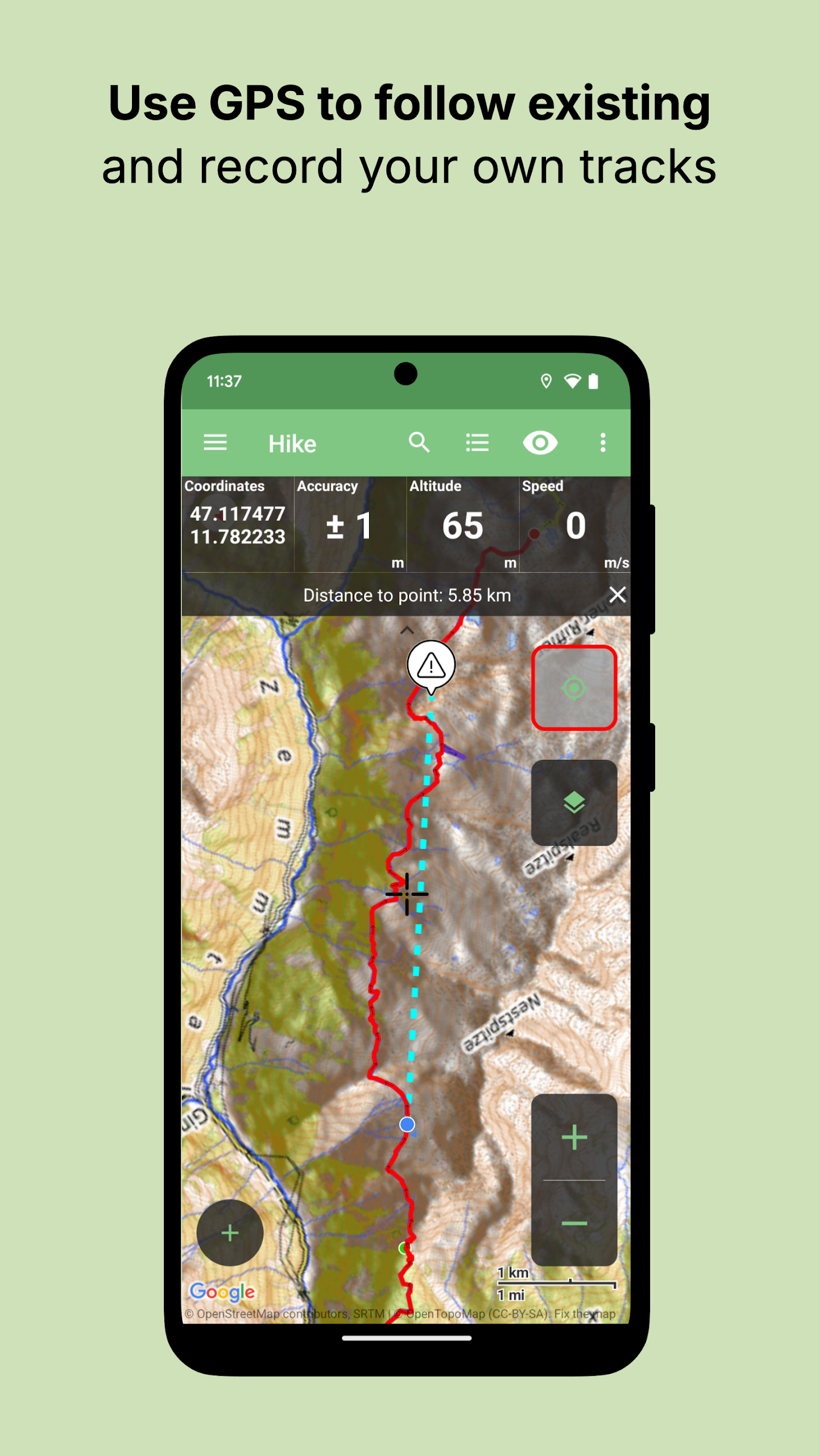
Hit the red “Record” button, name your track, and start moving to capture your route in realtime.
Is it possible to edit multiple tracks and merge them together?
Yes, use the “Merge” feature to combine multiple tracks seamlessly for a complete journey visualization.
Conclusion:
Tracklia offers a comprehensive set of features for users to import, edit, create, and share GPS data effortlessly. With robust file support, editing tools, and map choices, users can customize their navigation experience to suit their preferences. Whether you're a hiker, biker, or outdoor enthusiast, Tracklia provides all the tools you need in one intuitive platform for a seamless adventure planning and tracking experience.
Information
 Google Play
User Comments

RidePueblo puts real-time transit information in your pocket so residents and visitors can navigate public transportation across the City of Pueblo with confidence. The app displays live arrival times and moving vehicle locations on an interactive map, shows route maps and timetables, and locates nearby stops based on your current GPS position. Whether you commute, attend classes, or are visiting for an event, RidePueblo helps reduce uncertainty by delivering current transit details in a compact, phone-friendly interface.

77 Transporte - Motorista is a dedicated driver app built to help professional drivers receive, evaluate and manage ride requests with speed and clarity. 77 Transporte - Motorista places emphasis on essential tools — timely trip alerts, a visible distance preview to help you decide whether to accept, and a direct call option that uses your device carrier for voice communication — so drivers can remain productive during active hours without unnecessary features getting in the way.

IZI Recarga EV is a practical mobile app designed to help electric vehicle drivers locate charging points, start and monitor charging sessions, and track consumption so everyday charging is simpler and more sustainable. The app puts a searchable map and session controls in your hands, offers clear billing and usage history to help plan trips and manage running costs, and connects drivers to a network of stations that prioritize renewable energy and predictable service.

Surf Life Log is a compact surfing logbook app that helps surfers record sessions, track conditions and choose better spots. The app lets you save date and time, location, wave size, wind direction and force, crowd level, photos, notes and personal ratings so you can review past rides and identify what works. Built for individual device use, Surf Life Log visualizes your activity with simple statistics and charts and includes a map-based surf-spot search. Surfers who want organized logs and clear insights into their preferred conditions will find this tool practical and straightforward.

ES Car - Motorista is a driver-focused mobile app built to connect professional drivers with nearby ride requests, enabling them to accept trips, manage pickups and improve daily earnings with clear, practical tools. The interface prioritizes real-time notifications so drivers see incoming offers immediately, and ES Car - Motorista gives a quick distance preview before a driver commits to a booking. With pre-registered users and an option to call passengers directly through the app for urgent coordination, the design emphasizes predictable interactions and safer exchanges between drivers and riders.

AUVES is a private transportation app designed to make requesting rides quick and predictable from your Android device; AUVES appears in this description to help you identify the service and understand how it fits into daily travel. From the initial booking screen you can set a pickup location, enter or select a destination, and review an estimated fare before confirming a trip. The app is built around straightforward controls and clear trip information so that both occasional users and regular commuters can complete bookings in seconds and monitor the ride in real time.