 X
X
 facebook
 WhatsApp
 Email
Email
Introduction
高德地图 provides accurate maps, turn-by-turn navigation, public transit routes and local search for users across cities. It offers real-time traffic updates, offline map downloads and voice guidance to assist drivers and pedestrians.
Overview
高德地图 integrates mapping, route planning and place search in a single app. Frequent map updates and live traffic data help plan efficient routes for driving, public transit, walking and cycling. The app supports offline use by downloading regional maps for travel without a continuous data connection.
Key features
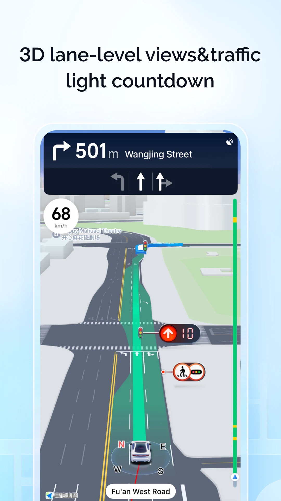
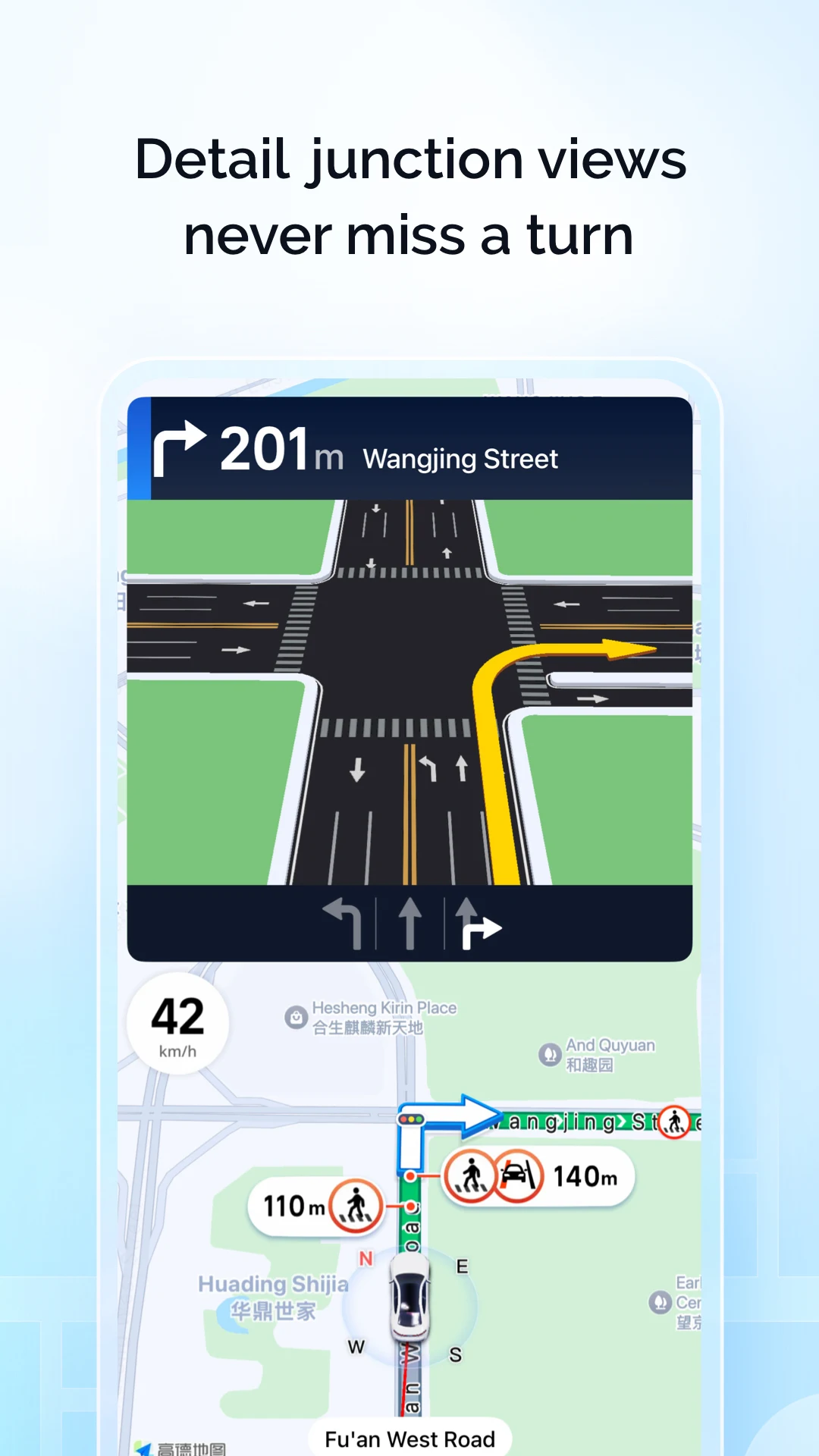
- Navigation: Turn-by-turn voice guidance with lane assistance and automatic rerouting when delays occur.
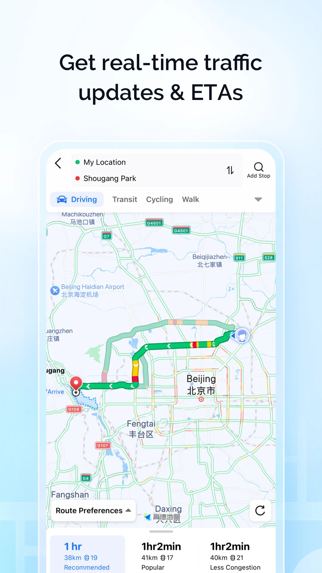
- Traffic & Transit: Real-time traffic conditions, estimated arrival times and multi-modal public transit routing.
- Offline maps: Download regional maps to navigate without mobile data.
- Local search: Find restaurants, stations, parking and other points of interest with contact details and basic ratings.
- Route options: Compare fastest, shortest and low-traffic routes and save frequent destinations.
Tips
Enable location services, keep map data updated and download offline regions before travel. 高德地图 maintains updated POI listings and traffic feeds to help you plan trips reliably.
Information
 Google Play
User Comments

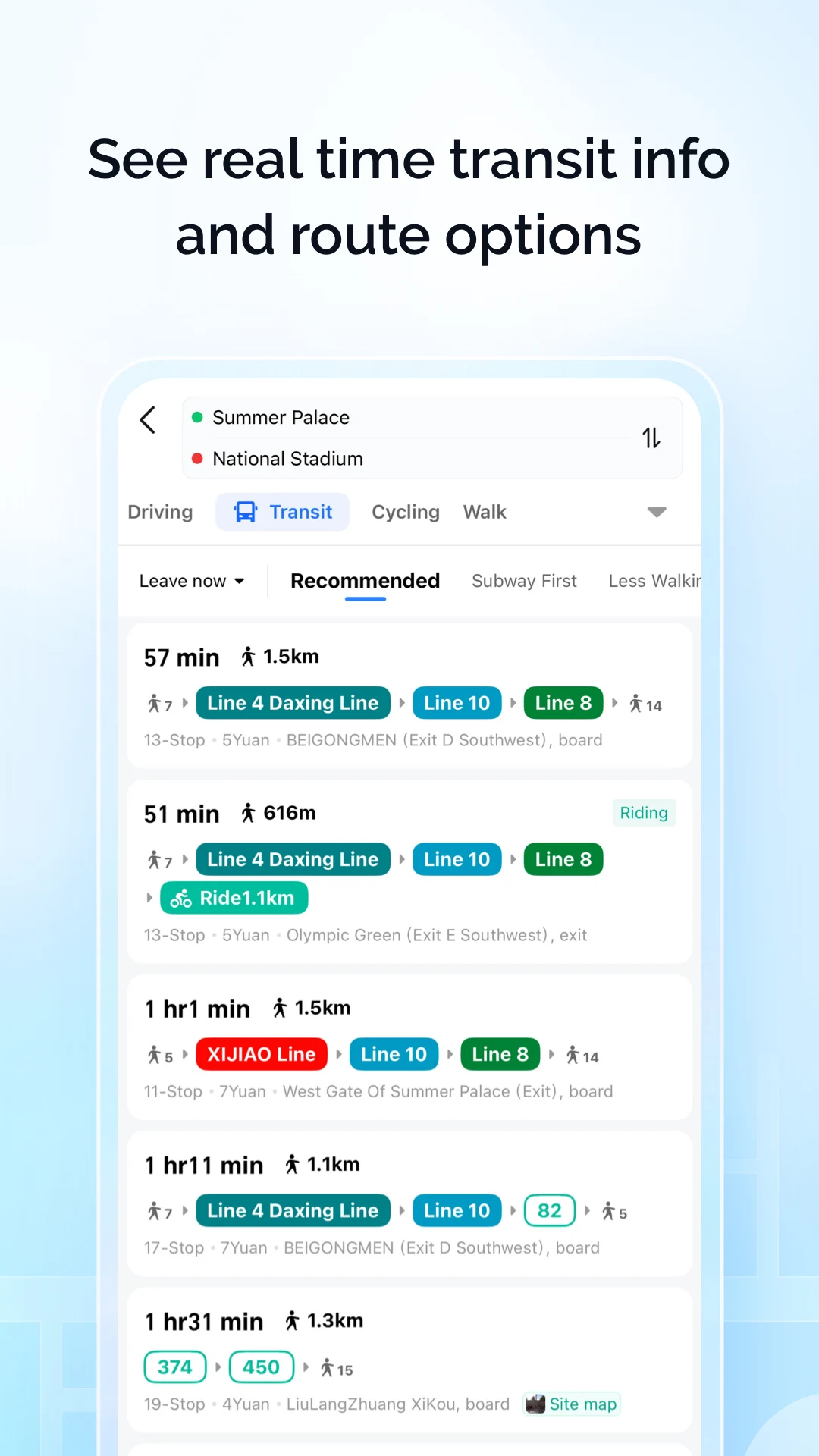
RidePueblo puts real-time transit information in your pocket so residents and visitors can navigate public transportation across the City of Pueblo with confidence. The app displays live arrival times and moving vehicle locations on an interactive map, shows route maps and timetables, and locates nearby stops based on your current GPS position. Whether you commute, attend classes, or are visiting for an event, RidePueblo helps reduce uncertainty by delivering current transit details in a compact, phone-friendly interface.

77 Transporte - Motorista is a dedicated driver app built to help professional drivers receive, evaluate and manage ride requests with speed and clarity. 77 Transporte - Motorista places emphasis on essential tools — timely trip alerts, a visible distance preview to help you decide whether to accept, and a direct call option that uses your device carrier for voice communication — so drivers can remain productive during active hours without unnecessary features getting in the way.

IZI Recarga EV is a practical mobile app designed to help electric vehicle drivers locate charging points, start and monitor charging sessions, and track consumption so everyday charging is simpler and more sustainable. The app puts a searchable map and session controls in your hands, offers clear billing and usage history to help plan trips and manage running costs, and connects drivers to a network of stations that prioritize renewable energy and predictable service.

Surf Life Log is a compact surfing logbook app that helps surfers record sessions, track conditions and choose better spots. The app lets you save date and time, location, wave size, wind direction and force, crowd level, photos, notes and personal ratings so you can review past rides and identify what works. Built for individual device use, Surf Life Log visualizes your activity with simple statistics and charts and includes a map-based surf-spot search. Surfers who want organized logs and clear insights into their preferred conditions will find this tool practical and straightforward.

ES Car - Motorista is a driver-focused mobile app built to connect professional drivers with nearby ride requests, enabling them to accept trips, manage pickups and improve daily earnings with clear, practical tools. The interface prioritizes real-time notifications so drivers see incoming offers immediately, and ES Car - Motorista gives a quick distance preview before a driver commits to a booking. With pre-registered users and an option to call passengers directly through the app for urgent coordination, the design emphasizes predictable interactions and safer exchanges between drivers and riders.

AUVES is a private transportation app designed to make requesting rides quick and predictable from your Android device; AUVES appears in this description to help you identify the service and understand how it fits into daily travel. From the initial booking screen you can set a pickup location, enter or select a destination, and review an estimated fare before confirming a trip. The app is built around straightforward controls and clear trip information so that both occasional users and regular commuters can complete bookings in seconds and monitor the ride in real time.