 X
X
 facebook
 WhatsApp
 Email
Email
Introduction
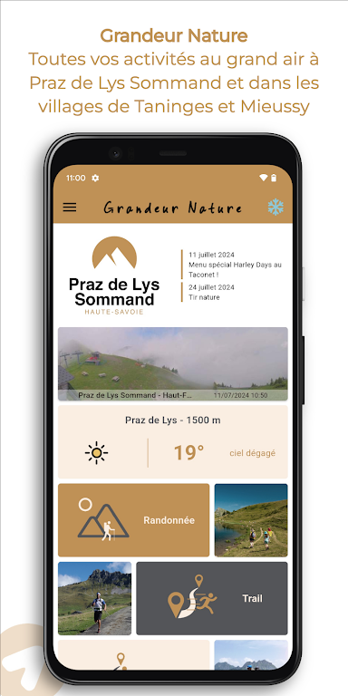
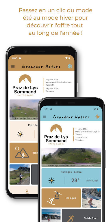
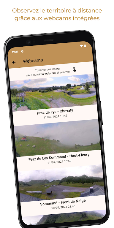
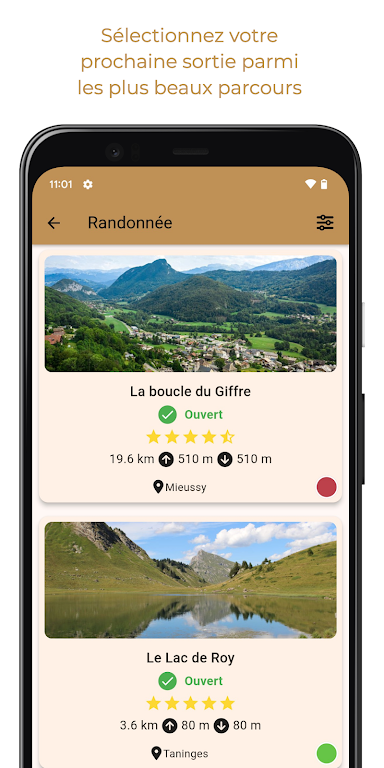
Experience the beauty of the great outdoors in Flaine and Les Carroz with Grandeur Nature! With detailed IGN maps and Open Topo Map available for download for offline use, you can explore high mountain pastures, forests, streams, and lakes with ease. Whether you're into trail-running or simply enjoy hiking, this app has everything you need to make your outdoor adventure unforgettable. From tracking your location on the map to recording your chronos, receiving route alerts, and even sending emergency SMS messages, this app is your ultimate companion for exploring the stunning landscapes of Flaine and Les Carroz.
Features of Grandeur Nature:
- Detailed IGN maps with GPS location
- Recording of chronos
- Point of interest descriptions
- Emergency alert system
- Weather updates
- Social media sharing
Tips for Users:
- Make sure to download maps for offline use before heading out on the trails
- Use the emergency SMS feature in case of any problems or emergencies
- Keep an eye on your chronos to track your progress
- Share your experiences and routes on social media to inspire others
- Stay updated on the weather conditions for a safe and enjoyable run
Conclusion:
With Grandeur Nature, you can explore the stunning landscapes of Flaine and Les Carroz while enjoying various outdoor activities. The app's features, such as detailed maps, emergency alerts, and social media sharing, make it a must-have for trail runners in the area. So download Grandeur Nature now and start planning your next adventure in the mountains!
Information
 Google Play
Other Games by the Same Yoomigo
User Comments

RidePueblo puts real-time transit information in your pocket so residents and visitors can navigate public transportation across the City of Pueblo with confidence. The app displays live arrival times and moving vehicle locations on an interactive map, shows route maps and timetables, and locates nearby stops based on your current GPS position. Whether you commute, attend classes, or are visiting for an event, RidePueblo helps reduce uncertainty by delivering current transit details in a compact, phone-friendly interface.

77 Transporte - Motorista is a dedicated driver app built to help professional drivers receive, evaluate and manage ride requests with speed and clarity. 77 Transporte - Motorista places emphasis on essential tools — timely trip alerts, a visible distance preview to help you decide whether to accept, and a direct call option that uses your device carrier for voice communication — so drivers can remain productive during active hours without unnecessary features getting in the way.

IZI Recarga EV is a practical mobile app designed to help electric vehicle drivers locate charging points, start and monitor charging sessions, and track consumption so everyday charging is simpler and more sustainable. The app puts a searchable map and session controls in your hands, offers clear billing and usage history to help plan trips and manage running costs, and connects drivers to a network of stations that prioritize renewable energy and predictable service.

Surf Life Log is a compact surfing logbook app that helps surfers record sessions, track conditions and choose better spots. The app lets you save date and time, location, wave size, wind direction and force, crowd level, photos, notes and personal ratings so you can review past rides and identify what works. Built for individual device use, Surf Life Log visualizes your activity with simple statistics and charts and includes a map-based surf-spot search. Surfers who want organized logs and clear insights into their preferred conditions will find this tool practical and straightforward.

ES Car - Motorista is a driver-focused mobile app built to connect professional drivers with nearby ride requests, enabling them to accept trips, manage pickups and improve daily earnings with clear, practical tools. The interface prioritizes real-time notifications so drivers see incoming offers immediately, and ES Car - Motorista gives a quick distance preview before a driver commits to a booking. With pre-registered users and an option to call passengers directly through the app for urgent coordination, the design emphasizes predictable interactions and safer exchanges between drivers and riders.

AUVES is a private transportation app designed to make requesting rides quick and predictable from your Android device; AUVES appears in this description to help you identify the service and understand how it fits into daily travel. From the initial booking screen you can set a pickup location, enter or select a destination, and review an estimated fare before confirming a trip. The app is built around straightforward controls and clear trip information so that both occasional users and regular commuters can complete bookings in seconds and monitor the ride in real time.