
 X
X
 facebook
 WhatsApp
 Email
Email

Introduction
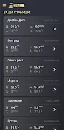
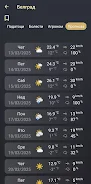
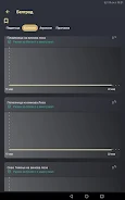
Melvine is an automatic weather station and companion mobile application designed for precision, digital agriculture. Melvine collects, processes and displays meteorological parameters from field sensors and integrates disease forecast models so farmers and agronomists receive local, actionable information about microclimate and biological risk. The app pairs with a physical station to deliver near‑real‑time charts, local forecasts and model outputs that help plan planting, irrigation and protection measures while reducing unnecessary inputs and improving yield timing.
Key features
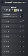
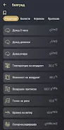
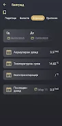
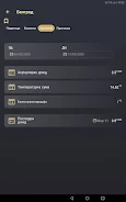
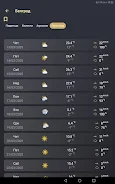
The Melvine app presents processed data from a field sensor array that typically includes air temperature, relative humidity, soil moisture, wind, solar radiation and precipitation, and it presents these readings as interactive time series and summary views. Onboard processing in the station and the app converts raw readings into standard units, computes derived indicators such as leaf wetness duration and degree‑day accumulations, and runs disease forecast algorithms to estimate onset, duration and intensity of common crop diseases and pest pressures. The app also records historical logs for each sensor, lets you configure alert thresholds, and provides clear recommendations for timely protection measures when model thresholds are exceeded.
How it works
Melvine receives data from sensors deployed in the field and applies smoothing and validation to reduce transient noise. The disease models use those validated microclimate inputs to estimate risk windows; when conditions match a model’s risk profile, the app flags the period and explains the underlying drivers so users can make informed choices. Local processing reduces latency so warnings are timely, and the app keeps a time‑stamped archive of measurements and model outputs that supports retrospective analysis of events and interventions.
User experience and controls
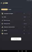
The interface focuses on quick comprehension and straightforward controls: interactive graphs let you zoom and pan through days, weeks or seasons, switch between metric and imperial units, and toggle individual sensors on or off. Notifications can be configured by risk level or by sensor threshold, and alerts include concise guidance tied to the model output. Melvine’s settings panel allows you to label stations or sensor groups by field or block, set notification schedules to avoid overnight noise, and calibrate sensors using simple offset adjustments when needed.
Progression, data history and decision support
Instead of a game-style progression, Melvine’s value grows with use as the historical dataset lengthens and your local baseline becomes better defined. Seasonal comparisons and cumulative statistics help users identify trends such as recurring wet spells or heat stress windows that affect variety selection and planting dates. The archive supports export of CSV summaries for agronomic records, and repeated, consistent monitoring increases confidence in forecasts and helps refine intervention timing over multiple seasons.
Visual style and accessibility
The app emphasizes legible typography, high-contrast charting, and color choices that convey risk without relying solely on color perception. Graphical elements are designed for both large tablet displays in offices and smaller screens in the field; important values are displayed in large text with concise explanations beneath. Melvine includes accessibility options such as adjustable font sizes and simplified views for users who prefer a minimal dashboard.
Offline use, installation and maintenance
Melvine supports intermittent connectivity by caching recent measurements and alerts locally so users can view recent history and receive warnings when a connection is absent. Installation requires mounting the station and placing sensors according to recommended heights and exposures; regular upkeep—battery checks, sensor cleaning, and occasional recalibration—ensures accurate continuous data collection. Melvine guides routine maintenance through reminders and diagnostic screens that report sensor health and signal strength.
Limitations and best practices
Users should expect that forecast and model accuracy depend on the quality and density of local sensor data; sparse coverage can limit microclimate precision and some disease models do not cover every possible threat or localized anomaly. Field maintenance is required to keep sensors operating reliably. For best results, combine Melvine data with field scouting and local agronomic advice so model recommendations are applied thoughtfully within the wider management plan.
Information
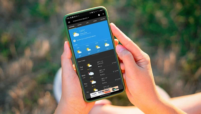
What are some reliable weather apps without ads? A great weather app not only helps you stay informed about daily weather conditions but also delivers accurate weather data. Some apps even come with smart voice alerts, ensuring you're always prepared when heading out. These weather apps are ad-free, with all forecasts and updates sourced from trusted meteorological organizations, providing you with the most precise information. If you're looking for such a tool, download and try one today!






User Comments

skateable helps skaters decide whether a park or spot is worth the trip by giving a live skateability score that combines current weather, the last 48 hours of rain history, surface type, sun exposure and drainage quality. The app summarizes conditions into a single 0–100 number, lets you plan sessions up to seven days in advance, and accepts recent reports from other riders so scores reflect ground truth rather than raw models. If you want to avoid wasted trips after rain or check a nearby plaza before heading out, skateable makes that choice easy and fast.

WITAL gives you weather in plain language, turning numerical model output into short, human-friendly sentences that explain temperature ranges, rain timing, wind and anything noteworthy for the day. If you prefer a quick, readable forecast instead of grids of icons and walls of numbers, WITAL is built for commuters, travellers and outdoor planners who need fast, practical information and an interactive chat assistant that answers location- and activity-specific questions in your language.

Melvine is an automatic weather station and companion mobile application designed for precision, digital agriculture. Melvine collects, processes and displays meteorological parameters from field sensors and integrates disease forecast models so farmers and agronomists receive local, actionable information about microclimate and biological risk. The app pairs with a physical station to deliver near‑real‑time charts, local forecasts and model outputs that help plan planting, irrigation and protection measures while reducing unnecessary inputs and improving yield timing.
Lịch Thủy triều Việt Nam is a practical tide reference app that lets coastal users, fishers, sailors and beachgoers check daily water levels across Vietnam. The app provides a date picker using the Gregorian calendar and shows the corresponding lunar calendar, so you can plan activities around tidal patterns and lunar phases. With a searchable list of locations you can filter and select one, several or all stations along the coast. Each chosen site presents a clear 24‑hour graph showing hourly water level in meters plus the day's highest and lowest tides with their times, making decision‑making faster and more reliable.
숨결주의보 is a mobile app that offers guided breathing exercises and ambient soundscapes to support relaxation, improved focus, and better sleep. 숨결주의보 includes session timers, adjustable pacing, and calming audio designed for short breaks or nightly routines.

Ventone collects and displays wind forecasts from the world’s best mathematical models and presents comparative views so users can quickly see where forecasts agree or diverge. The app rates each model based on average hourly error for 1-, 2- and 3-day forecasts, giving a clear signal of relative reliability. By aggregating multiple model outputs and offering an overview of differences, Ventone helps people who depend on wind forecasts make smarter plans and avoid unnecessary trips to outdoor spots when conditions are unlikely to match expectations.