 X
X
 facebook
 WhatsApp
 Email
Email
Introduction
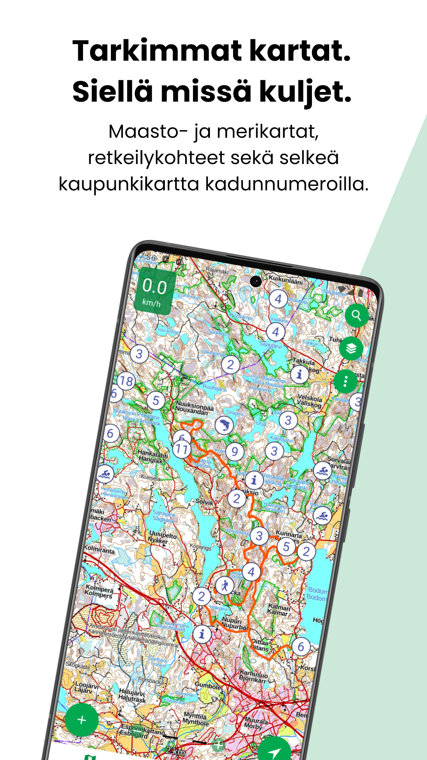
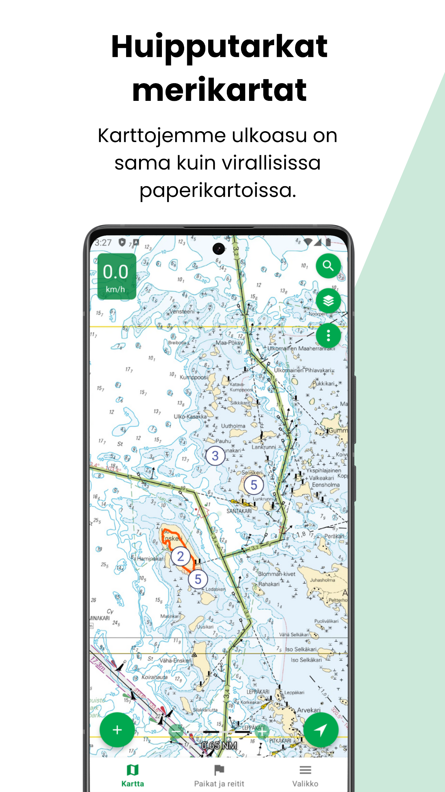
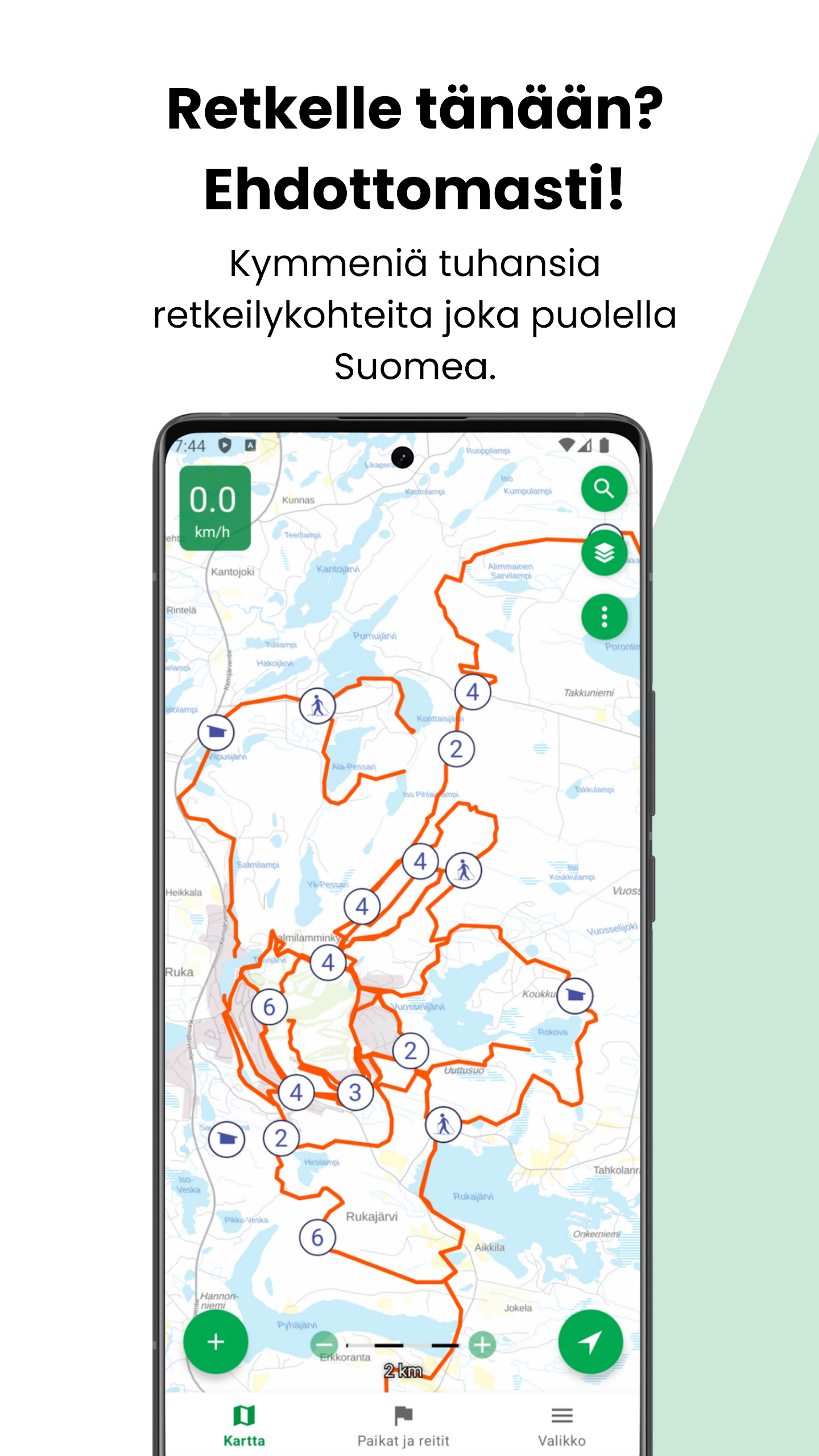
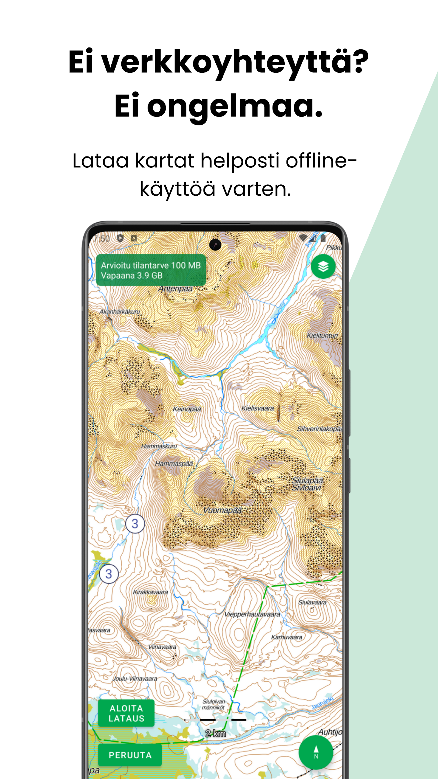
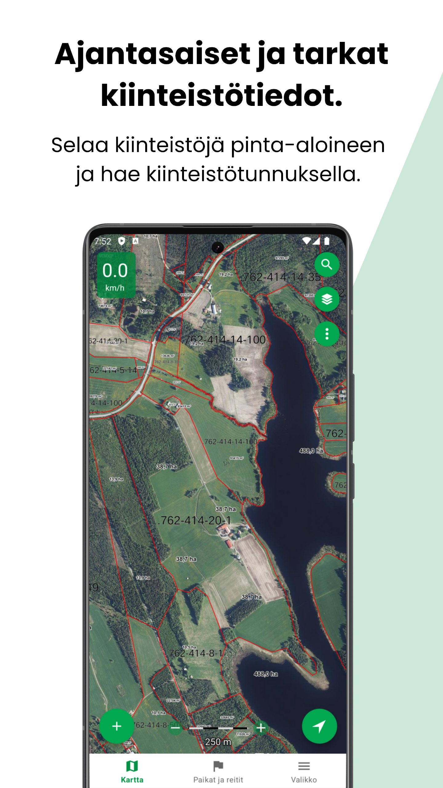
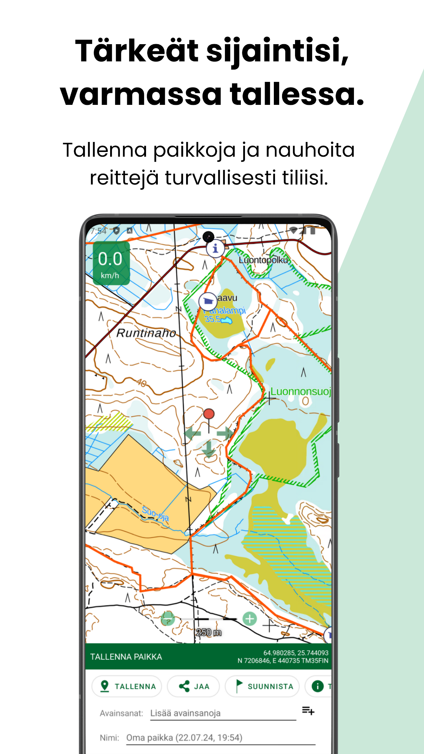
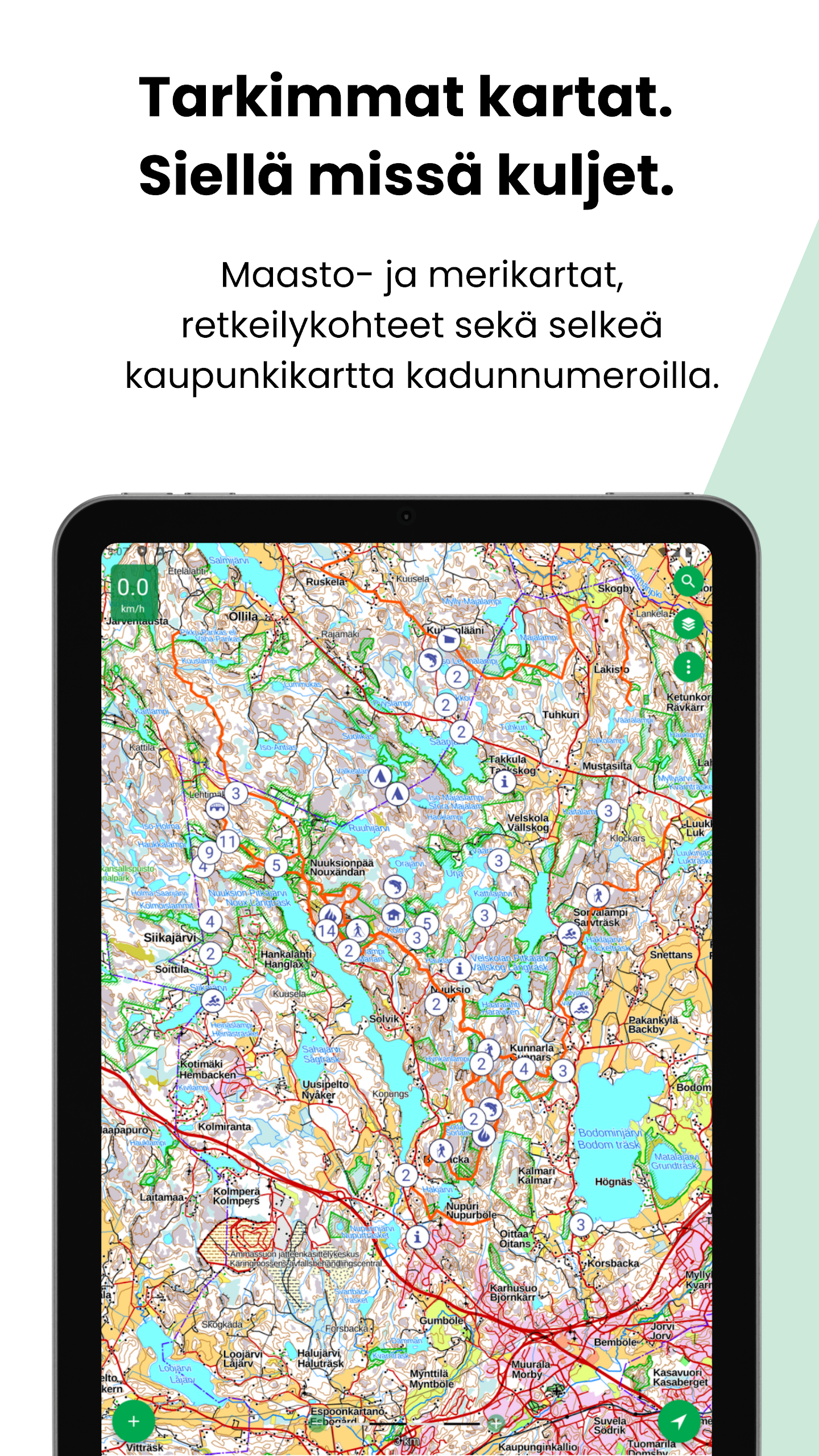
Karttaselain is an offline-capable mapping and GPS app that puts Finland's most accurate topographic maps, aerial photos, urban maps, marine charts, and property information in your pocket. It combines National Land Survey data, basic lake depth contours, and thousands of hiking resources — shelters, ski trails and snowmobile routes — with GPS tracking, route saving and GPX import/export. Casual hikers, anglers and boating enthusiasts will appreciate the free core maps, while professional users can unlock continuously updated marine charts, detailed depth data and property registers with a Plus subscription. The app also supports map rotation, compass guidance and a map feedback tool for suggesting updates.
Key Features
⭐ Offline-capable topographic maps and aerial imagery covering all of Finland, sourced from the national mapping authority.
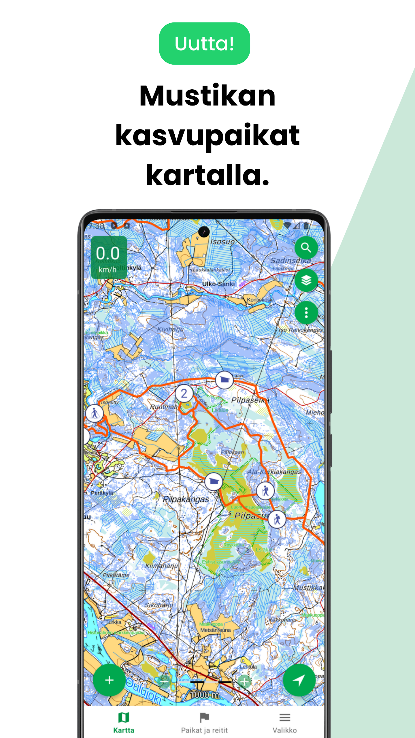
⭐ Extensive hiking resources and points of interest including shelters, ski tracks and snowmobile routes with thousands of locations.
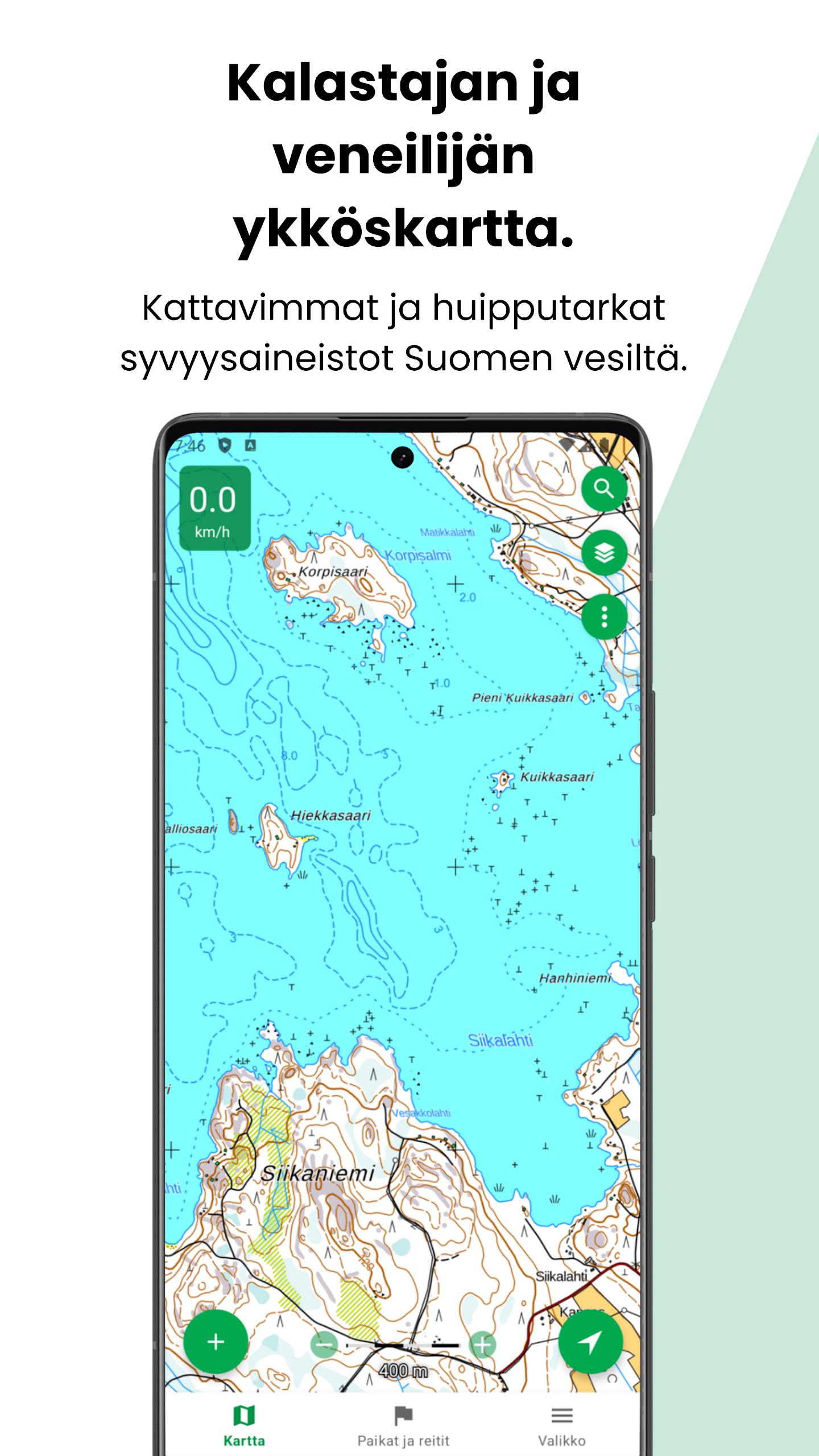
⭐ Marine charts with basic depth contours available for free and enhanced depth data via a Plus subscription for boating and fishing.
⭐ Property boundaries and property codes on maps, with continuously updated registers offered to Plus subscribers.
⭐ GPS tracking, route saving and GPX import/export plus map rotation, compass display and directional distance to a target.
Advantages
✅ Karttaselain gives access to official and regularly updated topographic data and high-resolution aerial photos.
✅ Offline downloads and reliable GPS tools make it useful in remote areas without mobile coverage.
✅ Plus subscribers receive detailed marine charts, continuous property updates, hillshade and forest orthophotos, and cloud sync of waypoints and routes.
✅ Route planning, area calculations and tracking features support outdoor recreation, boating and operational use.
Disadvantages
❎ Detailed depth charts, continuously updated property data and several advanced tools require a Plus subscription (trial available; subscription options include €9.99 for 2 months or €39.99 for 12 months).
❎ Some features such as map rotation and compass require a device GPS or digital compass to work correctly.
❎ Certain professional features like tracking devices and multi-user business licenses may require additional setup or separate agreements.
Development Team
Karttaselain is developed in collaboration with an active user community and maintained by a team that offers customer support and listens to user feedback through social channels and in-app reviews.
Version Information
Recent updates added slope shading (hillshade) and forest orthophotos to Karttaselain; these new map layers are available to Plus subscribers or during the trial period once the app is updated to the latest release.
Information
 Google Play

The Remote App Tool collection includes many Android apps that allow remote control. With the growing number of smart devices, it's easy to misplace remotes. These apps solve that problem, offering a convenient, free way to control your devices. They provide great convenience for your daily life!


Social networking apps have become essential tools in everyday life, making communication with others more convenient. These apps allow you to easily stay in touch with old friends while also providing opportunities to meet new people, helping to expand your social network beyond its usual boundaries. This page features a handpicked selection of the best social apps, making it your go-to choice for mobile socializing!


User Comments

RidePueblo puts real-time transit information in your pocket so residents and visitors can navigate public transportation across the City of Pueblo with confidence. The app displays live arrival times and moving vehicle locations on an interactive map, shows route maps and timetables, and locates nearby stops based on your current GPS position. Whether you commute, attend classes, or are visiting for an event, RidePueblo helps reduce uncertainty by delivering current transit details in a compact, phone-friendly interface.

77 Transporte - Motorista is a dedicated driver app built to help professional drivers receive, evaluate and manage ride requests with speed and clarity. 77 Transporte - Motorista places emphasis on essential tools — timely trip alerts, a visible distance preview to help you decide whether to accept, and a direct call option that uses your device carrier for voice communication — so drivers can remain productive during active hours without unnecessary features getting in the way.

IZI Recarga EV is a practical mobile app designed to help electric vehicle drivers locate charging points, start and monitor charging sessions, and track consumption so everyday charging is simpler and more sustainable. The app puts a searchable map and session controls in your hands, offers clear billing and usage history to help plan trips and manage running costs, and connects drivers to a network of stations that prioritize renewable energy and predictable service.

Surf Life Log is a compact surfing logbook app that helps surfers record sessions, track conditions and choose better spots. The app lets you save date and time, location, wave size, wind direction and force, crowd level, photos, notes and personal ratings so you can review past rides and identify what works. Built for individual device use, Surf Life Log visualizes your activity with simple statistics and charts and includes a map-based surf-spot search. Surfers who want organized logs and clear insights into their preferred conditions will find this tool practical and straightforward.

ES Car - Motorista is a driver-focused mobile app built to connect professional drivers with nearby ride requests, enabling them to accept trips, manage pickups and improve daily earnings with clear, practical tools. The interface prioritizes real-time notifications so drivers see incoming offers immediately, and ES Car - Motorista gives a quick distance preview before a driver commits to a booking. With pre-registered users and an option to call passengers directly through the app for urgent coordination, the design emphasizes predictable interactions and safer exchanges between drivers and riders.

AUVES is a private transportation app designed to make requesting rides quick and predictable from your Android device; AUVES appears in this description to help you identify the service and understand how it fits into daily travel. From the initial booking screen you can set a pickup location, enter or select a destination, and review an estimated fare before confirming a trip. The app is built around straightforward controls and clear trip information so that both occasional users and regular commuters can complete bookings in seconds and monitor the ride in real time.